À propos
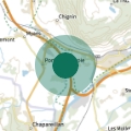
Orientation : Ouest, Nord-Ouest Coordonnées GPS : 45°26’46.4’’N - 06° 12’53’’E, altitude : 1992 m
Conditions de vols : conditions favorables par brise de pente, décollage souvent bien alimenté.
Dangers et difficultés : possibilité de brise forte dans la vallée des Huiles ligne Haute Tension sur la crête du pic de l’Huile.
Accès : Remonter la vallée des Huiles depuis La Rochette jusqu’au col du Cucheron. Prendre la 1ère à droite (500m) et se garer vers le chalet de la jasse (1550m). (accès possible par St Alban des Hurtières). Marcher jusqu’au col du Champet, puis suivre le magnifique chemin les crêtes des Mollards en prenant au sud jusqu’au Grand Chat. Superbe vue à 360° sur La Lauzière, Les Bauges, La Chartreuse. 450 m de dénivelé, environ 1h de marche.
Informations pratiques
-
Activités sur place


