À propos
Site ffvl n°: 73A008B, Coordonnées GPS : 45°27’02’’N - 06°06’20’’E, altitude : 300 m
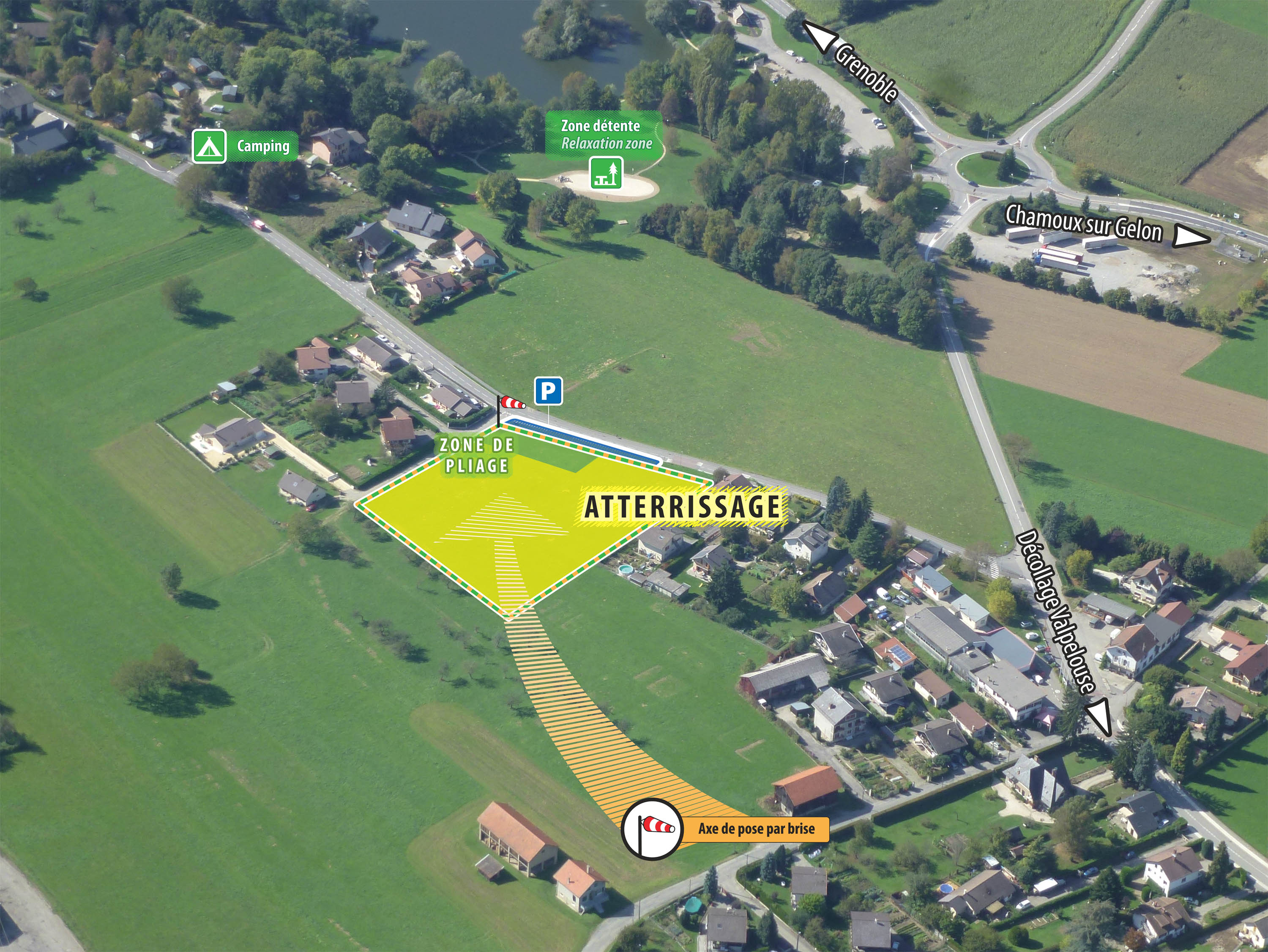
Observations/Dangers : Terrain pouvant être fermé avant les foins. Informations à l’atterrissage et sur le site des Tétras : http://lestetrasduvolgelon.free.fr. Atterrissage non visible du décollage, atterrissage proche de l’intersection de deux petites vallées.
Accès/cartes : 3433 OT - TOP 25 Allevard. Chemin de la Plaine en direction du camping (à proximité d’un petit lac).
Informations pratiques
-
Activités sur place
Ouverture
Contact & Accès
La Rochette
73110 Valgelon-La Rochette
73110 Valgelon-La Rochette